REMINDER: THE ARENA PLATFORM, INC. has no obligation to monitor the Forums. However, THE ARENA PLATFORM, INC. reserves the right to review any materials submitted to or posted on the Forums, and remove, delete, redact or otherwise modify such materials, in its sole discretion and for any reason whatsoever, at any time and from time to time, without notice or further obligation to you. THE ARENA PLATFORM, INC. has no obligation to display or post any materials provided by you. THE ARENA PLATFORM, INC. reserves the right to disclose, at any time and from time to time, any information or materials that we deem necessary or appropriate to satisfy any applicable law, regulation, contract obligation, legal or dispute process or government request. Click on the following hyperlinks to further read the applicable Privacy Policy and Terms of Use.
***Official FIRES thread***
- Thread starter JBerry
- Start date
Mostly acidicSo, I heard these crazy orange colors have to do with the coastal marine layer, keeping the smoke above it, and it re flacks the light differently...do you smell smoke? How is the air quality up there?
Ah, Orange Sunshine...Mostly acidic
Bingo!Ah, Orange Sunshine...

I spent a bunch of time at Bass Lake as a kid right around this time of year. Never would have seen this coming.
Don't really smell smoke but you can sense it.So, I heard these crazy orange colors have to do with the coastal marine layer, keeping the smoke above it, and it re flacks the light differently...do you smell smoke? How is the air quality up there?
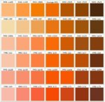
What color is your sky? SF has been moving between PMS 156, 158, 1585, 164, 167
That place is creepy as it is. Kinda weird they opened back up.One of my nieces sent me this link of fire related imagery.
Enchanted Forest is right on I-5 south of Salem, north of Albany...a small kid theme park.
Imagine the memories if they let your family and kids in today:
View attachment 97539
Got a smoke free sesh yesterday after work ..... pretty fun but still had some residual respiratory effects. Dark to the south with central coast complexes. Prob last time I surf until it clears and looks flat anyways for at least a week. Everything is socked in today west of the Cascades. East side looks decent. Rain forecast for Monday
")
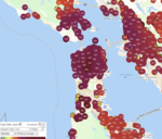
Moveable map here
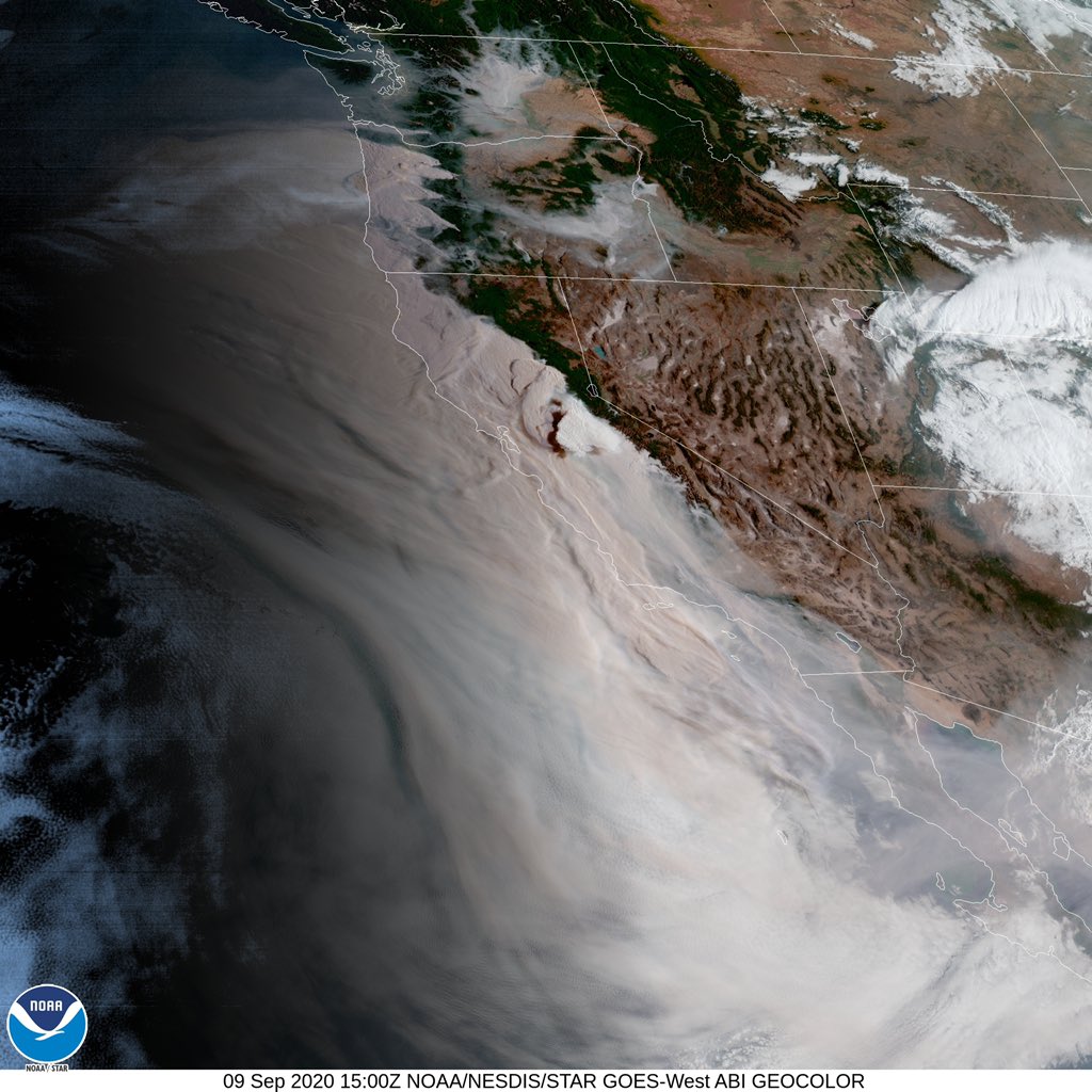
Interesting link to what it looked like to take off from SFO yesterday here (click me).
Less orange here today but just DARK. Rode my bike an hour each way to work and back yesterday. Didn't feel or smell it on the way in but did on the way home.Today in SF, the sky is more yellow than orange, but much more smokey. A fine layer of white pepper ash looks to be sprinkled over my plants and the windows. Hazardous air anyone?
Moveable map here
View attachment 97561
Interesting link to what it looked like to take off from SFO yesterday here (click me).

The desperate fight to save his family ends in tragedy
 www.oregonlive.com
The visibility has improved dramatically but the air around here smells smokier. More so yesterday than today.Today in SF, the sky is more yellow than orange, but much more smokey. A fine layer of white pepper ash looks to be sprinkled over my plants and the windows. Hazardous air anyone?
Moveable map here
View attachment 97561
Interesting link to what it looked like to take off from SFO yesterday here (click me).
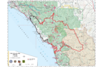
846,812 acres
Mendocino Nat. Forest, Northern CA
North Complex (21% contained)
252,313 acres
Lake Oroville, Northern CA
Creek Fire (6% contained)
196,667 acres
Shaver Lake, Central CA
Dolan Fire (40% contained)
115,440 acres
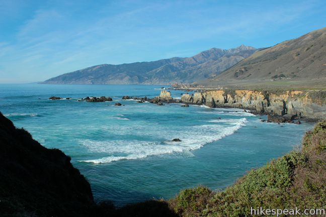
Big Sur, Central CA
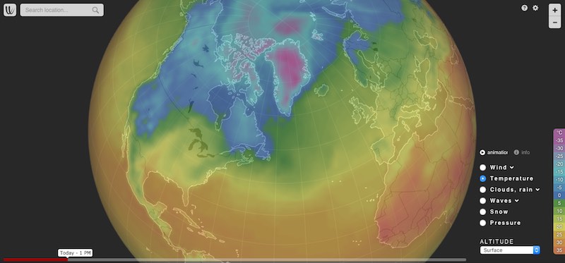
Current winds
I was watching KSBW news on Thursday. They were standing on the Kirk Creek bridge, right next to the campground and filming the fire on the ridgetops right above. So freaking sad. We have been doing camping trips down there in late Sept/early October for 30+ years now.August Complex (25% contained)
846,812 acres
Mendocino Nat. Forest, Northern CA
North Complex (21% contained)
252,313 acres
Lake Oroville, Northern CA
Creek Fire (6% contained)
196,667 acres
Shaver Lake, Central CA
Dolan Fire (40% contained)
115,440 acres
Big Sur, Central CA
Current winds
Covid 19 was the original kicker. We didn't make reservations thinking the campground would be closed. Glad now we didn't. It would have been money thrown down the drain. We were down there camping when Obama couldn't do his do and didn't get a Federal budget signed. Federal campground. It closed. Every person in the campground was ordered to bail. No refunds....
Treebones is on the south side of Cape San Martin, so there is still a ways to go.Dolan FIre! It's gotten much further south than Naci rd, almost to Plaskett. Looks about to Treebones area.
Also, as the fire moves south into Pacific Valley, the density of trees is dramatically lower along the highway and inland, so the firefighters have a better chance at plowing some fields to make a stand. You can see in the photo below how tree density is drastically reduced in this area vs. north Big Sur.
Also, the lower brush stuff grows back fast. Sadly, the tall Redwoods, Oak, Pine, Walnut, and Cypress trees don't.
Either way, hopefully later this week the weather will cool a bit and they can grab that fire and settle it down!