What island is this??

oneworlded

Administrator
Jun 4, 2004
3,628
2,654
113
Murrica
chrisdixonreports.com
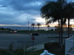
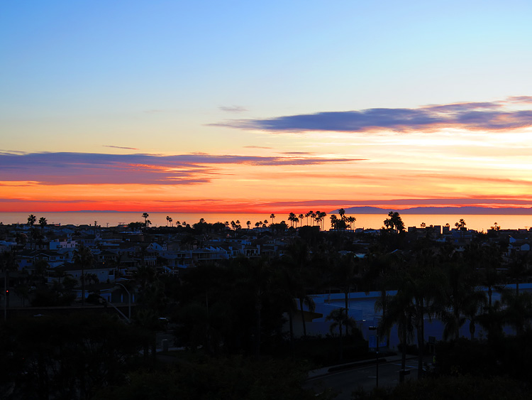
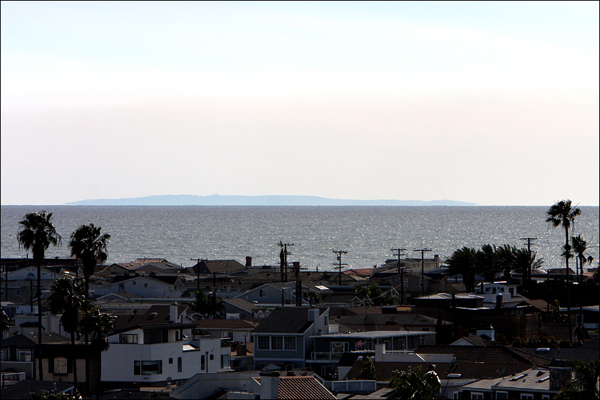
Sunset in Dana Point. There's an island I've never seen between Catalina and San Clemente Islands - between the two palm trees at the edge of the Strands parking lot. Is there some weird visual anomaly allowing me to see San Nic? Did Cortes rise from the depths? WTF?
IMG_3422.JPG
 

Firebird

Gerry Lopez status
Jun 5, 2010
1,174
1,164
113
OC
Well, you taught me more about the Channel Island chain than any other source, so if you don't know, I'm stumped.
I will say however, that during this time of year and with these weather conditions, I have seen mirages that look like islands off the CA coast.
 

keenfish

Duke status
May 12, 2002
18,831
6,607
113
Trona
www.pbase.com
FTR, San Nic would be way to the right and long out of view/line of sight.

But.. with line of sight on "Flat Earth" we could probably see it if that darn Catalina Island wasn't in the way.
 

Bohter

Michael Peterson status
Mar 7, 2006
2,665
232
63
FTR, San Nic would be way to the right and long out of view/line of sight.

But.. with line of sight on "Flat Earth" we could probably see it if that darn Catalina Island wasn't in the way.
Shoots....must be Hawaii eh....:unsure:
Possibly clouds....looks pinkish like the surrounding ones...
In your head...In your head....you are thinking....
 

Ranga

Billy Hamilton status
Dec 31, 2008
1,685
1,427
113
See Distant Horizons thread. Or the one about the plane on there treadmill. #Science
 

One-Off

Tom Curren status
Jul 28, 2005
14,213
10,420
113
33.8N - 118.4W
Looking at a map San Nic would be directly behind Catalina when viewed from Dana Point. I'm guessing it is a cloud.
 

rts265

Phil Edwards status
Oct 19, 2007
6,190
1,307
113
My guess is isla Guadalupe. When you take into account the curvature of the earth and light refraction aka science, makes sense
 

Bohter

Michael Peterson status
Mar 7, 2006
2,665
232
63
"What island is that to the left of Catalina" was the caption on this photo posted on the old EdHat SB site a few years ago. Shot was taken at 1100 ft just east of the Romero trailhead off Bella Vista in Montecito. So...what island is that? :cool: